zpires

Maps

the World of Mutania

Northeast Zige
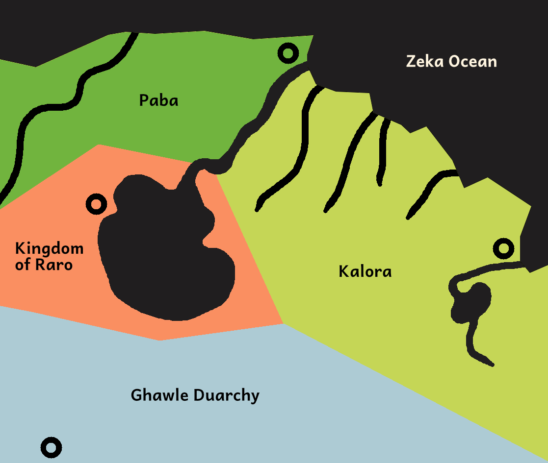
the northeast continent of zige featuring the kalora region with various rivers and a small lake, the paba region bordering it to the north with one major river, and kingdom of raro with the large inland sea, and the ghawle duarchy to the south

The interactive version of this map can be found here on World Anvil.

  • Paba capital: Sepo
  • Kalora capital: Tiyo
  • Kingdom of Raro capital: Raro
  • Ghawle Durachy capital (one of 2): Kugmak
The second capital of the Ghawle Durachy, Iwatik, is too far south to be on the map of this portion of Zige.

Yalisi Empire

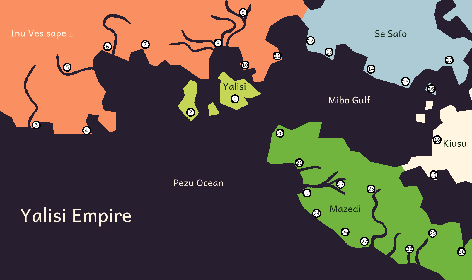
map of the yalisi empire which centers around three large islands in the middle of the pezu ocean, there is a region in the north, the southern part of a large continent, a small landmass to the east that makes up the se safo region, another landmass to the east that makes up the edge of the kiusu region, and a large peninsula connected to kiusu called mazedi

The interactive version of this map can be found here on World Anvil.

Cities

Greater Yalisi

  1. Yalisi
  2. Levegi's Palace

Inu Vesisapi I

  1. Votusuda
  2. Ironuro
  3. Mexanoxe
  4. Lotebo
  5. Sijepaxede
  6. Sipusu
  7. Elonuro
  8. Mojumibo
  9. Nuromiboudi

Se Safo

  1. Nitenuro
  2. Senisuda
  3. Xibo
  4. Veraau
  5. Vamozu
  6. Zediduvanuro

Kiusu

  1. Lubovabi
  2. Milifi

Mazedi

  1. Logisuda
  2. Ivanu
  3. Pesaru
  4. Vasaru
  5. Sezamexa
  6. Vaexpoxigu
  7. Supobisuda
  8. Zijipi
  9. Lepavotu
  10. Zevati
  11. Utiutu